.png)
.png)
.png)
.png)
.png)
.png)
.png)
.png)
.png)
.png)
.png)
.jpg)
.jpg)
%20(1).png)
.jpg)
.jpg)
.jpg)
.jpg)
.jpg)
%20(2).png)
.png)
Our Story
Built in the Field. Backed by Engineering.
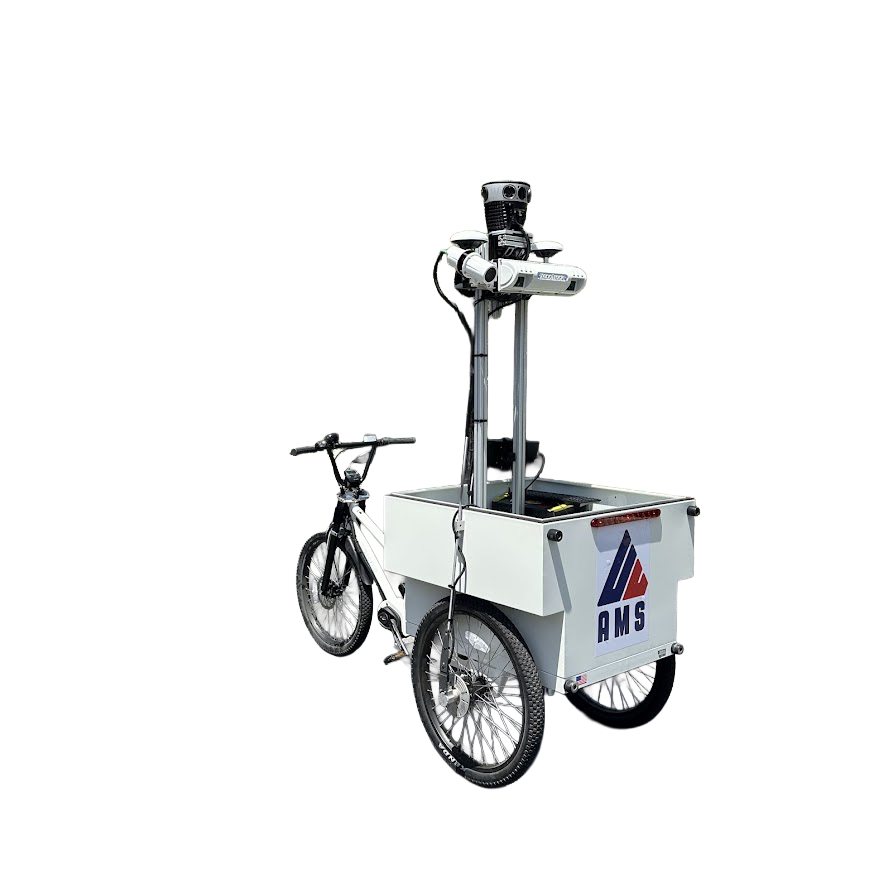
AMS Consulting wasn't built as a thesis project or funded by venture capital. We started in the field, walking roads, rating pavements, and collecting infrastructure data for real agencies with real problems. Nearly 20 years later, we're still out there, but now with technology we built ourselves to do it better.
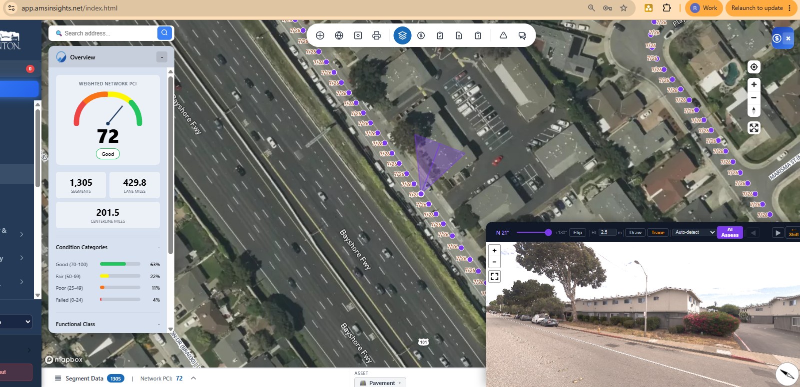
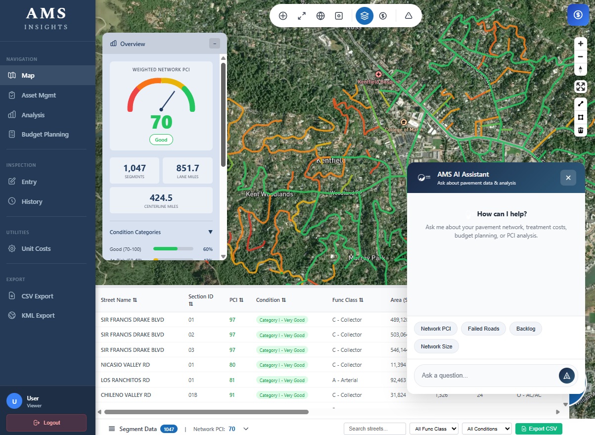
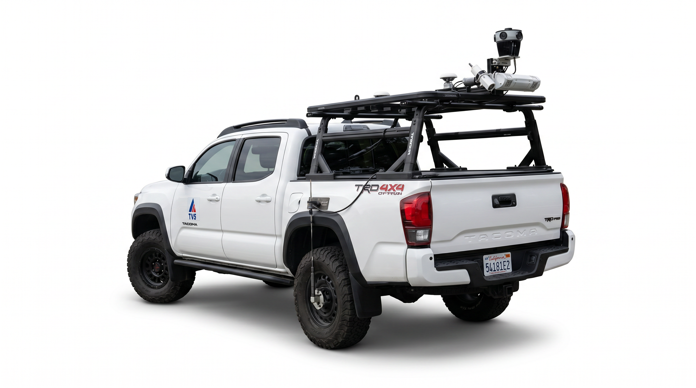
That hands-on experience, combined with our engineering backgrounds, is what drives everything we build. Our hardware and software weren't designed in a lab by people guessing what agencies need. They were built by the same team that's been doing the work, because we knew there was a better way to collect accurate data without cutting corners on the fundamentals. Every image we capture is georeferenced so you know exactly where it was taken, not just what it shows.
Every project is backed by rigorous quality assurance. A Qualified Pavement Rater oversees every PCI survey, our pavement scanners have proven to meet AASHTO R56 standards at NCAT, and our technology validates the data at every step. We don't replace expertise with automation; we use technology to make expert-level work more consistent and efficient.
We're a hybrid: part field services company, part GovTech company. Most firms are one or the other. We do both, and that's what allows us to help agencies go from raw data collection all the way through to asset management planning, prioritizing assets based on condition and level of service so your team knows exactly where every dollar should go.